Faial is part of the Central Group. The capital is Horta. Approaching Horta early morning
 |
| local spelling of Azores |
I took a tour of the island and I loved the island, it had a really nice feel. Reminded me of Yorkshire with green hills and cows. Or Shetland, where I’ve never been. It is clean and green and beautiful.
We went up the hills and stopped at a view point overlooking Horta and could see Pico island.
We could also see our ship, it's the one in the foreground -
An old windmill -
Faial is said to get its name from the firetree, or faya. Myrica faya (firetree, faya) is a species of Myrica, native to Macaronesia (the Azores, Madeira, and the Canary Islands). A firetree -
Went through Flamengos which is a Flemish town. Onto Caldeira, the volcano. We went up to 914 m. There is a short pedestrian tunnel through to a viewpoint over the crater which is 366 m deep. The rim is 8 km. The crater floor is vegetated and there is a mini volcano in the centre. Unfortunately it was still cloudy. The area is a nature reserve. Again we could see Pico Island.
We descended on a hairpin red surfaced road. This is where cows are taken to graze all summer. The don’t go to barns to be milked, instead portable machines are used -
We later went past a cheese factory.
A store for tools, from when the workmen didn't have motorised transport -
We saw lava flows that are covered with grass, as well as a lava covered river bed -
Down to the coast and along through Ribeira Funda village and others, and had a view of several volcanoes in a line-
Onto the Capelinhos Volcano. This volcano emerged from the sea in 1957. At first a local thought it was a whale as the Atlantic Ocean began to boil. The eruption continued for 13 months and covered this part of the island with ash. Many derelict houses are now at road level as the new road was built on layers of ash. The terrain has some vegetation but is still covered with ash. An old whaling village was covered in ash, one building has since been restored. The lighthouse was partially covered and is now a museum. There are sea caves.
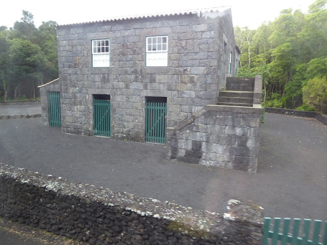
We continued on, through Capelo then did a loop around a picnic park and Gruta do Parque. We saw a typical house, with storage space underneath, and steps up to the living floor above. Outside is a large circle for drying crops, outbuilding, toilet, pig house and a frame for drying corn -
We later saw an example of bananas growing inside shelters made from incense trees -
Drove along above the coast, past the headland of Castelo Branco and then Horta airport, then past some sea caves and back to Horta
Porto Pim by Horta -
I then went for a walk around Horta
The marina is known for the many paintings, done by sailors before they leave port -
We left Horta in the evening -
Next stop was Sao Miguel.


No comments:
Post a Comment