Enjoy!!!

Enjoy!!!

Sunday, November 11, 2007

Trekking into Virgin Belum - WildAsia

Trekking into Virgin Belum

With the Temiar Orang Asli as guides, LIZ PRICE treks into one of the last unexplored rainforests in Malaysia, the Belum Temengor in Perak, and bides for sights of rare large mammals.

[published on Wildasia.net 15 June 2002]

THERE are not many places left in Peninsular Malaysia which have been unexplored, but Belum may be one such locality.

Belum comprises a large area of virgin forest in northern Perak and although a few areas are now opened up for tourism, the remainder of the Belum area is inaccessible and seldom visited, as it still remains a security area. This is left over from the days when it was a black area, due to the activities of the Communist Party of Malaya (CPM).

The CPM engaged in guerilla warfare against the Malayan government. The govemment declared a State of Emergency which lasted from 1948 until 1960. During this time there were many skirmishes between the authorities and the communist bandits and most of the mountainous and forested areas of Semenanjung were known as black areas, where the security forces were operating. The CPM finally surrendered in 1989 and it was only in 1991 that the curfew in Belum was lifted.

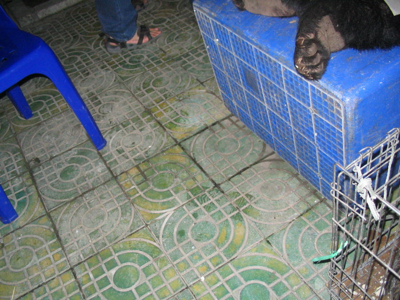
Prior to the 1990s, Belum had been largely unexplored, and it was only when the Malaysian Nature Society began a two-year scientific expedition there in 1993 that it was realised how rich Belum Forest is in terms of flora and fauna. There is virgin forest with valleys and mountains, crystal clear streams, waterfalls, and a few limestone outcrops. The area is inhabited by the Orang Asli and there are many wild animals especially the larger mammals rarely seen now in other parts of Malaysia, such as tiger, elephant, seladang, bears and deer.

Belum is in Ulu Perak and includes the Temengor and Belum Forest Reserves covering an area of over 113,000ha . It straddles the East - West highway. Today the tourist areas are those in the south, at Pulau Banding and Sungai Kenyir. People can enter with a special permit, but the easiest way is to join a tour group. So I went along with Yusof Aziz from Try Adventures, an adventure outfit that deals in specialised tours to the more ulu areas.

The adventure began in the small town of Gerik. From there, we drove 38km to Temengor Dam, going past the smaller lake of Bersia. The road was littered with elephant dung, obviously these creatures had been in the area recently. At the dam, we transferred to two boats and set off on the one hour ride across the lake. At one stage Yusof told us we were just passing over the site of a village, which was drowned when the dam was created in 1978.

Of course there was nothing to be seen. A couple of limestone outcrops caught my eye, but there was no sign of any caves. I noticed there were very few dead trees sticking up out of the water, whereas on a previous visit to the Sungai Halong area, dead trees were a part of the landscape. We landed at Sungai Kenyir, one of the southern fingers of the lake. There is an Orang Asli village close by. The Temiar tribespeople are very shy and gentle, but amazingly strong. Three of these Temiars accompanied our group as guides/porters. One of them was laden with a full rucksack with three tents tied -- I tried to lift the pack, and could hardly raise it off the floor let alone carry it for three hours.

The trek to our camping site took about three hours at a moderately slow pace, the only obstacles being one hill and six river crossings. In fact, we had to do the first crossing immediately upon starting, even before we entered the forest. The water was amazingly clear, such a treat to see. But the current was deceptively strong and the safest way to cross was to hold hands and form a human chain. No one wanted an unexpected dunking whilst laden with luggage, so crossing in twos or threes proved to be the best way.

As we trekked further in, we soon noticed the differences in vegetation in various areas. One of our guides, Ramli, said this area is known as the Bamboo Area, because of these abundant plants growing all around.

Bamboo is a member of the grass family, and is one of the most versatile and useful of all the plants in the forest. It can be used for constructing shelters and furniture, as water containers and cooking pots, utensils, musical instruments and, of course, as food. Ramli knows this forest well, having served here during the Emergency days, so he was a mine of useful and interesting information.

We were shown wild Tongkat Ali, medicinal herbs, lianas which contain water safe to drink, wild bananas and gingers. Gingers are among the flashier members of the plant world, with showy flowers, and some have red coloured canes with dark red inflorescences on the stem. The dipterocarp trees are impressive through their sheer size, with straight trunks piercing the sky high above. We saw meranti, chegal and keruing.

Unfortunately there was no sign of any animals at all except for leeches. These made their presence known, in fact they were everywhere. They must have been very hungry and we donated much blood to them. For some of the real city dwellers amongst the group, it was their first encounter with these wriggly blood suckers, and it was interesting to watch their reactions as the leeches latched on to their human prey. Leeches are actually quite interesting, with their 34 internal body segments, 10 eyes and three horny jaws. Not forgetting the muscular suctional disk at each end of the body. Seeing leeches is a good sign that there are other mammals living in the area, so it shows that Belum has a resident fauna population.

Our camp was set up by the river. The open air bathroom had an abundance of clear pure free-flowing water, admittedly rather cold, but so clean you can safely drink it straight from the river. Dinner was prepared and the Orang Asli started a fire, using bamboo kindling. That night we drifted off to sleep lulled by the sounds of the river surging by.

The next day we trekked up to Kelawah waterfalls. There are a series of eight waterfalls, and we went as far as the second. Many people swam in the pool at the base of the fall, but the water was definitely chilly. It was cold even just sitting around by the fall as the wind was blowing the spray. Despite the cold, there is something fascinating sitting and staring at water, especially when faced with such a beautiful fall as this. We were mesmerised by the beauty of the place. However we moved to a more sheltered spot for lunch, and a couple of us climbed up to the top of this fall to look down on the others sitting below.

The following day, we trekked back to Kuala Kenyir and that evening the Orang Asli arranged a bersewang (traditional dance) for us. The women sing and play instruments made out of differing lengths of bamboo which are banged on a log, whilst the men dance. Of course our group was expected to join in with the merrymaking and were given hats made from coconut leaves.

On the final day, we visited the Orang Asli village as the doctor in our group was asked to look at one of the village elders. The bamboo houses were perched high above the lake, with a few food crops growing between the houses. As we headed back for the Temengor Dam, we stopped at Syra Tersau which is a small sulphur lake and hot springs. Animals come here to drink the water, and there were signs that elephants had been recent visitors. Our boats then carded us back across the lake, homeward bound. Our visit was made all the more enjoyable and fun with having such knowledgeable guides like Yusof and Ramli explaining the secrets of the forest to us city dwellers. Between them, they were a mine of information as they certainly knew the jungle and were willing to share with us their knowledge. They were also very concerned about group safety and made sure everyone was safe especially when doing the river crossings. Thanks guys.

© Liz Price

Ghost Tours in Kuala Lumpur - Wildasia

Haunting the Haunts: Ghost Tours in Kuala Lumpur

A sceptic of the supernatural world, LIZ PRICE ventured on a tour that took her from Bangsar to Seputeh to Pudu prison in search of spirits, ghosts and pontianaks. The result? An intriguing insight into the world of Asian superstitions, taboos and beliefs.

[published on Wildasia.net 24 Aug 2004]

When I told my friends I was going on a ghost hunt that night, they laughed. One, a Malaysian, said, "What, in KL?" Another one, a mat salleh, made a comment on the fact that I am a sceptic of the spiritual world, so why would I spend time looking for ghosts. But as there is no harm in looking, why not give it a go. As they say, seeing is believing, so maybe if I saw something, it would change my opinion that ghosts and spirits don't exist.

So that is why later that night, I found myself sitting in a van with other would-be ghost hunters. We had joined a Spooksters tour, run by Francis Nantha, Chief Spookster. Francis told us that we should be safe enough, as metal is a repellant to sprits, therefore the vehicle should give us some protection. But for added measure we all tied a thin yellow thread around our right wrists.

The nightly tours start at Bangsar with a seafood dinner, where the group is given an introduction to the spirit world. Food is an integral part of Asian life for protection against the supernatural. Asian cultures are full of superstitions and beliefs, which have all got jumbled up by intermixing of the various cultures. It was interesting to learn that most of the customers are foreigners. Is this because Asians are too scared to delve in to the spiritual world, or is it that foreigners are more curious and want to find out about these Asian beliefs?

Before joining the tour I had no clear idea about the difference between spirits and ghosts, but Francis explained all this as we headed for the first stop. I learnt that there are three types of spirits, namely ghosts, gods and demons. Ghosts are basically people who have died, and I was amused to learn that some ghosts think that they are the ones living and us human beings are the dead ones! It seems that we can sense spirits in four different ways, by hearing, sight, touch and smell. A lot of people claim to have seen a ghostly apparition, especially at traffic lights, or have heard a strange noise. If you feel something brush your skin, but see nothing, this could be a spirit passing by. If it gives a sense of cold it is a ghost, whereas a demon gives off heat. If you notice an out of place smell it means a spirit is present. People report smelling fruit or flowers where no such things are in the vicinity.

Our first stop was the Indian temple at Mid Valley Mega Mall. Here we were told how spiritual beliefs affect building construction, both in Malaysia and other Asian countries. Steps needed to be taken to appease spirits before, during and after any development. At this particular temple is a tree believed to have been blessed by the Gods.

Then we went up to the Seputeh Chinese cemetery. I have walked through the cemetery at daytime, as it is nice and peaceful and a haven for small wildlife, as well as providing good views over the city of KL. It covers a huge area and is a real green lung close to the heart of KL. It is about 130 years old. I find it fascinating to walk around looking at the old graves, and there is one section dedicated to Yap Ah Loy, the supposed founder of KL. So to find myself walking through this cemetery in the wee hours of the morning, clutching a lit incense stick was a new experience.

The object of the exercise was to get good luck and a spiritual blessing. We were to walk past the gravestones until we found one we felt was calling to us, then to put the joss stick in the earth in front of the grave. Sadly, I felt nothing. It was a bit ironic that the three cynics of the group were the ones walking, whereas the others in the group, who were believers, were too scared to get out of the vehicle.

We stopped at a shrine, where people, and spirits apparently, come to pray and give offerings. The shrine is a good example of how the Chinese, Indian and Malay cultures have got intermingled, as one of the statues is a Chinese figure wearing a Malay songkok. I have often noticed this in cave temples in Malaysia. Inside what seems to be a Chinese temple, there is often a smaller shrine with gods from the Indian religion, and vice versa in Indian temples.

Spooksters started their tours at Halloween 2002. When I heard that it was almost their first anniversary, the question that came to mind is 'do ghosts have birthdays?' Or should that be 'deathdays'? After all, if us mortals celebrate our births, I wonder if ghosts celebrate the day they departed from this realm.

Off to prison.

We headed for the Pudu Prison, which is on the edge of the Golden Triangle area of KL, opposite the new Times Square. It is easily recognisable by the long mural painted on the outer walls. This prison first opened its doors in 1891 and was expanded to accommodate up to 2000 prisoners. However in 1985 there were more than 6650 prisoners, resulting in chronic overcrowding. Sometimes more than 10 people had to share a cell and take turns to sleep. The prison finally closed in 1996, and the following year opened briefly as a tourist attraction.

The site was the scene of many executions over the years, and even today there are thought to be many spirits still lingering around the place, both ghosts and demons of mortals who tried to escape. I visited the prison when it was open to the public and although I didn't see any otherworldly beings, people are sure they exist. There are plans to build a shopping complex on the site, but first, the remaining phantoms have to leave. I wonder where they will go.

Next place on the itinerary was the Pontianak Den. This is something I knew nothing about so perhaps was the most interesting for me. It is located in an exclusive area of KL, where the pontianaks are said to reside in banana trees, and may be seen sitting in trees and on walls. Pontianaks are vampires, commonly thought to be the mother of a dead child who is out to seek revenge in the form of blood. But Francis has a creepier story - in the old days if an unmarried woman got pregnant, and the man would not marry her, she would turn to a bomoh for an abortion. Due to primitive methods it was not unusual for the woman to die. As she was dying she would be angry and would curse. The curse of the dying woman is very powerful. Her body was dumped in a valley, but the woman would rise, and kill the boyfriend then look for the bomoh. However the bomoh had protected himself from her curse. As the pontianak hadn't completed her task - she had killed the boyfriend but not the bomoh - she could not rest in peace.

Pontianaks have been likened to sexual sirens who attract men. This area, where the bomohs used to live, is infamous and many taxi drivers will refuse to go there due to bad experiences. There are many tales of a driver having picked up a woman, and on arrival at the destination would ask for the fare only to find the taxi empty, or the woman would pay but then float off down the road, a body with no legs. The fear of pontianaks in rural areas is really great. If you've ever seen a beautiful lady whilst driving along a quiet road at night, or whilst waiting at traffic lights, and she suddenly disappears, maybe you've seen a pontianak.

Another Asian being is the toyol, which reminds me of a miniature goblin. It is believed to be a baby who died at birth, or an aborted foetus. It is raised as a zombie by a bad bomoh. It is very feared as it can steal and even kill if its master so wishes.

Our last stop was the old KL railway station, the scene of numerous suicides in the past. Many people have jumped off the road bridge in front of passing trains. And as a result people have seen ghosts in that area - but remember, seeing a ghost is often a sign of danger, so beware. When the station was in operation in its heyday, one particular bench was often reported to be occupied by ghostly figures. I wonder if they have moved away now that the trains no longer stop here. Maybe they have moved to a bench in KL Sentral?

Despite my sceptism, it was a fascinating tour. It is an intriguing insight into the world of Asian ghosts and superstitions, taboos and beliefs. And don't worry if you don't believe, as it is a great opportunity, in Francis's words, "to laugh at what Asians fear and find taboo". But if you are a believer, you should still go, as you will certainly still gain some new knowledge. Did anyone see a ghost…… well that would be telling. Go and find out for yourself…..

© Liz Price - article may only be republished with the author's permission.

Khao Yai National Park: Thailand's Oldest Sanctuary - www.wildasia.net

Khao Yai National Park: Thailand's Oldest Sanctuary

Khao Yai is considered by many to be among the best national parks in the world and was recently designated an ASEAN National Heritage Site. LIZ PRICE took a peek into Thailand's oldest national park and found that plenty of adventures remain.

[published on Wildasia.net 4 Jan 2006]

It was 6.30 am and a thick fog reduced visibility to almost zero. The rain was falling and it was hard to see the road ahead. The windscreen wipers did little to help as they only removed the raindrops, leaving the fog still blanketing the road ahead. I was glad I wasn't driving. I really thought I was back in England during the depths of winter, and had to keep reminding myself that I was in tropical Thailand in the height of summer.

We had an early start as it is supposedly a good time to see the native inhabitants of the park. But I was wondering if any self-respecting animal would be out in this lousy weather. I didn't think many birds would be flying, and all reptiles would surely be hiding until the day got warm enough for them to venture forth. Maybe some of the park's mammalian dwellers would put in an appearance.

Khao Yai National Park is Thailand's oldest national park. It covers an area of over 2000 square kilometres and includes one of the largest intact monsoon forests in mainland Asia. Considered by many to be among the best national parks in the world, Khao Yai was recently designated an ASEAN national Heritage Site. When the park was established in 1961, the Thai government removed all hotels and golf course facilities from the park in order to reduce human influences on the park environment.

The park encompasses a wide variety of habitats, including a variety of rain forest terrains, evergreen forests and grasslands, as well as secondary forests. There are several mountains of around 1000 meters including Khao Khieo and quite a few waterfalls, the tallest and most spectacular of which is Haew Narok at 80 metres.

Covering such a large area means the park is able to house a large variety of flora and fauna. Almost 2500 plant species have been recorded. The most obvious landscape is the rainforest. The park is unusual in that a main road runs through the park. Visitors to Khao Yai as well as people just using the road to pass through have to pay the park entry fee. Of course vehicles have to observe the speed limit and drive carefully. It takes about 50 minutes to drive from one side to the other, from Pak Chong in the north to Prachin Buri on the south side.

The park is home to 67 species of mammals, many of which are endangered species. The abundant wildlife consists of elephants, gibbons, tigers, leopards, Asiatic black bear and Malayan sun bears. There are sambar, barking deer, gaur, wild pig, serow and various gibbon and macaques. Generally these animals are more easily spotted during the rainy season from June to October.

As we prepared to leave the hotel in the morning, I could hear gibbons calling from the forested mountains surrounding the hotel. But they were too far away to see. Driving into the park, the first furry residents we saw were a group of long tailed macaques on the roadside. They were playing on the telegraph wires and foraging for food. As our car slowed down to look at them, they in turn looked at us, maybe hopeful of a free breakfast.

After driving some time through forested area, we came to a place of open grassland. Our driver spotted 2 deer on the grass, contently grazing, oblivious of the rain. Even when we stopped the car and pointed our cameras at the deer they were not too perturbed, and continued to feed.

Driving through the park, I was amused to read the road signs. One said "Beware tiger zone". The next one read "Cobra crossing caution". I had visions of a family of cobras slithering across the road, but of course, none were to be seen. Another sign warned us "Beware you are entering wild elephant area". Some 200-300 wild elephants have been recorded within the park's boundaries

Khao Yai is famous amongst bird watchers, and many ornithologists come here from all over the world. More than 300 species of bird have been recorded. The park is home to some of Thailand's largest hornbills, including the great hornbill, as well as the wreathed hornbill, Indian pied hornbill and rhinoceros hornbill. The best time to see the hornbills is January to May, especially in the ficus trees as they feed on the figs. Generally you hear hornbills before they see them, as the sound of their wings is quite distinctive when they are flying.

There are some caves in the park, although I didn't get a chance to visit any. However I read that the caves are home to rare wrinkle-lipped bats and Himalayan ribbed bats. The entire area of the park is criss-crossed by over 50 km of hiking trails, ranging in length from one and a half to eight kilometers. There are 13 hiking trails, but note that on some trekking trails it is best to be guided by experienced forestry officials.

Before beginning any activities in the park, it is best to go to the Visitors Centre. Here you can get information on what to see and do in the park, and arrange guides for trekking. Apart from the trails and waterfalls, there are three wildlife-watching towers. There is a small reservoir, areas of grassland, and a salt lick. Although there are basic lodges in the park, we had opted to stay in a resort outside the park. At Pak Chong on the north side, there is a wide range of resorts, many catering to European tour groups, and advertising French, Italian and other Western cuisines. The resorts spanned many kilometres of road leading to the park. However at Prachin Burin on the other side of the park, I only noticed one or two resorts.

We stayed in Juldis Khao Yai Spa and Resort. This offers a variety of accommodation, Thai and European cuisine, and there is a nice pool. The more energetic can ride a bike, play tennis or go horse riding or canoeing.

Khao Yai park is a great place to explore. You can see parts of the park from the comfort of your car, but of course to see more you have to go on the hiking trails.

Getting There

Khao Yai is located northeast of Bangkok, in Nakhon Ratchasima Province. You can access it from Pak Chong, which is on Highway 2 between Nakhon Ratchasima and Saraburi. Pak Chong is 25 km from the park's northern entrance. Alternatively the southern entrance is reached from Prachin Buri.

If travelling by bus, take a bus from Bangkok's Northern bus terminal to Pak Chong. From here you can take a songthaew to the park gates. The journey takes about three and a half hours.


© Liz Price - article may only be republished with the author's permission.

Juldis Khao Yai Resort : Juldis Khao Yai Resort is located at 17 Km. on Thanarat Road, the main road leading to Khao Yai National Park. 54 Moo 4 Thanarat Road, (Km.17) T.Moosri, Pakchong, Nakorn Ratchasima 30130. Phone 0-4429-7297.

Tonle Sap: The Great Lake of Cambodia - Wildasia

Tonle Sap: The Great Lake of Cambodia

Photo-taking, bird-watching and fish-eating are some of the things you can do at Tonle Sap, as LIZ PRICE experienced it. Being the richest freshwater fishing ground in the world, the lake supports about 3 million people or a quarter of Cambodia's total population.
[published on Wildasia.net 1 Apr 2006]

We were flying over a huge expanse of wetland and my first thought was there had been big floods recently. But then I could see that the flooded area was actually permanent, a mix of marshland and lake. It was immense. I hadn't done my homework and read up on the area, so I didn't know anything about this lake.

The plane landed in the small, international airport of Siem Reap in Cambodia. Siem Reap is the gateway to the world famous Angkor Wat temples. Although these temples were to occupy us for the next few days, we actually went to the lake by chance on our first afternoon. I had found out it was called Tonle Sap, and is the largest permanent freshwater lake in Southeast Asia.

That afternoon we wandered around the market area of Siem Reap, absorbing the atmosphere and getting a feel for the place. There were several beggars following us, mainly amputees, victims of the landmines that have plagued Cambodia for the last decade. Other people clamoring for our attention were the romauk drivers. Romauks are the motorcycle taxis, commonly known as tuktuks, although they don't resemble the tuktuks seen in Thailand. They are motorcycle trailers. They only exist in Siem Reap and are a very good invention, as two people can sit side by side. We spent some time haggling for a good price to go to the lake and finally a fee of 10000 riel (RM 10) was agreed on.

On the way, we stopped at Krouser Thmey, which is an NGO that supports orphans. They have an exhibition center and the main display is about Tonle Sap Lake. Here I learnt that one quarter of Cambodia's population, some 3 million people, live on the lake. Many are very poor and live in very rudimentary boathouses. It is the richest freshwater fishing ground in the world. The people living by the lake rely on the fish for their livelihood and survival.

As we left Siem Reap we drove along one continuous street, which was lined with houses for several kilometers. There was so much to look at, as there was a lot of activity all around and also as it was my first visit to Cambodia I found everything new and fascinating. I wanted to take photos but it was quite bouncy sitting in the tuktuk even though we were not going fast. The houses decreased in size and frequency and eventually became small huts with the open floodplain of the lake behind. Ahead of us, Phnom Krom was the only hill in sight. Phnom means hill in Cambodian.

Phnom Krom is 12 km south of town. We parked near the market area that was bustling with activity. We walked through the village, although you can hardly call it a village, as it was simply a row of small, basic huts built on a causeway edging the lake. From here the express boats go to Phnom Penh and Battambang, which are the two largest cities in Cambodia. Dozens of express boats were moored in a long line, and as I went to take photos the boatmen called out trying to sell tickets for the following day.

Although this village is incredibly poor, the people seemed happy and content and were quite friendly. The kids all said hello and loved having their photos taken and even the adults didn't mind our camera lenses pointing everywhere. No one begged or asked for anything, which was quite a contrast to what we had seen earlier in Siem Reap. The houses were so basic and small and there is no electricity or running water. However they do have clean water, as there are communal hand pumps.

My camera was clicking furiously as I found it all really fascinating. One lady was grilling a rat over some charcoal. I did a double take, as at first I didn't realize what she was cooking. But she obligingly held it up for me so I could take a photo. There were a few shops but they were incredibly spartan, with maybe just half a dozen different items for sale. We walked down to the start of the water village. Boats were weaving their way in and out of the maze of stilts supporting all the houses. People were selling and buying things, doing household chores or just relaxing and chatting, but many stopped to wave at me as I watched them.

We went back to the Gecko Environment Centre. This has displays on the flora and fauna of the area as well as information on communities living around the lake. The first item to catch my eye was a tank containing not fish, but snakes. To my amazement the caretaker stuck his hand in the tank and pulled out a fat snake and dumped it on the counter in front of me. Fortunately the snake just sat there and made no effort to escape.

There are six species of water snake living in Tonle Sap. Approximately 8500 snakes are caught a day during the peak of the wet season. They are used as food, and also eaten as a snack with palm wine, and their skin is used. Apart from fish, turtles live in the lake but are being heavily hunted and are now rare. Also the Siamese crocodiles are decreasing in numbers.

700 families live on Chong Khneas, which is the name of this particular floating village. The people are Buddhists from Cambodia, as well as Catholics and Moslems from Vietnam. They live on floating houses and wooden boats, and the village moves according to the season. Tourists need to rent a boat to see it properly. The villagers make their own fishing nets and use lights to attract the fish. Cages are used to rear fish such as the Snakehead. There are two main species of here, the Channa Micropeltes or Giant Snakehead, which is known as the Toman in Malaysia, and the Channa Striata or Common Snakehead, or Haruan. The Giant Snakehead is the most predacious of all snakeheads and grows up to one meter long.

These two Channa species collectively comprise the second most important fish group under culture in cages in the Mekong area. We saw it all the time in the Cambodian markets for sale, mostly dried, but sometimes fresh. The snakehead is not a pretty fish and it has some canine-like teeth, but it tastes good. We ate it several times, mostly as an amok dish, which is a Thai style curry.

The Tonle Sap Lake flows into the Tonle Sap River, which in turn enters the mighty Mekong River at Phnom Penh. The Mekong is the longest river in Southeast Asia, around 4200 km long. It is the third most diverse river in the world after the Amazon and the Congo. There are some spectacular large water bird populations, and over 1500 fish species. The Giant Mekong Catfish grows up to 300 kg and is a Critically Endangered species. Tonle Sap Lake itself is an incredible natural phenomenon. During the wet season the Mekong backs up into the river, causing the lake to swell from 2500 sq. km. to 13,000 sq. km. The maximum depth increases from 2.2m to 10m. In October after the wet season the flow reverses back into the Mekong.

This process makes Tonle Sap one of the world's richest sources of freshwater fish and a fertile spawning ground. The fishing industry supports about one million people in Cambodia and a dry season catch on the lake can average 100-200 kg a day. That was a good enough reason to enjoy the fish dishes in the restaurants.

© Liz Price - article may only be republished with the author's permission.

Parrot Rescue Centre -Wildasia

On the northern end of Seram, Indonesia, lies the Kembali Bebas Avian Centre, a rescue centre for parrots and other exotic birds illegally trapped for the pet trade. LIZ PRICE visits the sanctuary, climbing high into the treetops to spot an abundant range of amazing birdlife.


[Published on Wildasia 11 May 2007]


Indonesia's Parrot Rescue Centre: Rehabilitating the Caged Bird

Indonesia has some spectacular birds including parrots, cockatoos and Birds-of-Paradise. However their numbers are declining due to loss of habitat and trapping for the pet trade. Local people turn to trapping to provide an income to support their families.


The Kembali Bebas (Return to Freedom) Avian Centre is a rescue and rehabilitation sanctuary for parrots. It lies in northern Seram, the largest island in Indonesia's Maluku province. The centre rescues wild parrots (and some other birds) as well as pet birds from hunters and trappers.


The birds are cared for by Yayasan Wallacea (The Wallacea Foundation) and Project Bird Watch. These come under the Indonesian Parrot Project (IPP), a nonprofit organisation dedicated to the conservation of wild Indonesian parrots. The IPP's aim is to conserve and protect the endangered wild cockatoos and parrots of Indonesia whilst providing sustainable alternate means of income for local villagers in order to reduce trapping.


The centre is situated in the Masihulan dusun, near Kampung Masihulan, which is a few kilometres from the coastal village of Sawai in northern Seram. It was set up in October 2004. The main building operates as a clinic, store and house for the workers. The man in charge is tour guide Ceisar Riupassa (head of Yayasan Wallacea), and there are eight staff members working at the centre. The centre is slowly building up equipment such as books, binoculars, telescopes etc., as well as the equipment needed for tree platforms. The place is well maintained, very clean and well cared for.


To enter the area of cages, everyone has to step through a disinfectant footbath and wear face masks due to the risk of Avian Flu. There are three areas of cages. The first consists of small cages containing new arrivals, and these birds are quarantined and monitored until they are declared fit. They are then moved to the much bigger aviaries which are some distance away.


Here they undergo rehabilitation and preparation for release into the wild. They have to be taught what foods are suitable for them so that they can fend for themselves once released. We were warned not to reply to any birds that tried to talk to us, as they needed to lose their familiarity with humans. These cages are large enough for the birds to fly around.


I saw many different kinds of Lories; Rainbow, Moluccan, Purple-naped, Red, Chattering. There were White, Salmon, and Yellow-crested Cockatoos as well as an Eclectus Parrot. A large Cassowary also made an appearance. From Irian Jaya, there was a Blythe's Hornbill and from Aru,…two Kangaroos!


In March 2006 the centre released three endangered Salmon-crested (Seram) cockatoos back to the very forest where they were previously trapped by smugglers 18 months ago. The decision to release the birds was endorsed by the World Conservation Union and CITES. Many locals from Masihulan came to witness the release as it was a major event for the island.


Tree Platforms
The centre also has four tree platforms, ranging from 22 m to 45 m high. The 22 m one is inside the parrot centre. Visitors can easily reach the platform by wearing a harness and being pulled up on a rope-and-pulley system. The locals however climb up metal rungs in the tree trunk. The platform is situated just at canopy level and provides a bird's eye view over the surrounding forest and open areas. It's a great place for birdwatching. Whilst we were there we were served afternoon tea. It was quite an experience to sip coffee and munch on biscuits on a slightly swaying platform above the trees. We were lucky enough to see a cuscus in a distant tree. A cuscus is an Australian tree kangaroo. On Ambon I saw some traps used by locals for snaring cuscus, as it is a local delicacy there. The highest platform is 45 m high and can sleep eight people overnight. It is very popular with overseas visitors, especially over Christmas and New Year.


© Liz Price - article may only be republished with the author's permission.


Getting There
There are daily flights from Jakarta to Ambon by three different airlines. There are daily ferries from Ambon to Seram - the shortest crossing is to the southern port of Amahai. From there a good road goes all the way to Sawai, through the Manusela National Park. The parrot centre is located a few kilometres before Sawai.


I can recommend the services of Spice Islands Tours and Travel


The Other Ambon: Molucca- Wildasia

Fabled as the central city of the Spice Islands of Indonesia, LIZ PRICE offers a new look at the surrounding islands, dive sites, scenic coastlines, historic places and giant eels of this equatorial tourist haven.

The Other Ambon: Moluccas' Capital Gem


[Published on Wildasia 6 Aug 2007]
© Liz Price

The travel books from older days talk about the heady scent of spices filling the air of the fabled Spice Islands. As my plane landed in the tiny airport of Ambon, I was disappointed to smell nothing, not even aviation fuel.


Ambon is the capital of Maluku province. Together with North Maluku province, they are better known to Europeans as The Moluccas. The islands had been of interest to spice traders from as early as the 1st century, and later became known as The Spice Islands, due to the cloves, nutmeg, mace and cinnamon which grow there. It was these East Indies that Columbus was looking for when he accidentally found America in 1492. However, Ambon is not as famous for spices as some of the other islands, such as Banda and Saparua, where more of these spices are grown.


Pulau Ambon resembles two horseshoes back to back. Ambon City lies on the south side of the beautiful Ambon bay. The airport is located in the north, across the bay, and although a ferry connects the two, it is quicker to drive the 36 km. We went through a series of small villages, and the first thing that struck me was the number of churches. They were of many different designs and some villages had up to 4 churches of different denominations. Many were still under construction. Although Indonesia has the world's largest Moslem population, Maluku is home to a large number of Christians and it was common to see a mosque and church side by side.


Since the end of the heyday of the spice trade, The Moluccas became largely forgotten. Then, in recent decades, tourists discovered the great beauty of these islands, straddling the equator, and which have some of the world's most stunning dive sites. Sadly, the peace and religious harmony of these islands was shattered in 1999, when a minor dispute between a Christian and Moslem led to full scale riots, which lasted until about 2004. During that time many buildings were bombed and burnt, and whole villages were wiped out. The riots spread throughout many islands of Maluku.


Now peace is restored and the people are busy rebuilding and getting on with their lives. There is a building frenzy going on as Moslems and Christians help each other rebuild homes, as well as churches and mosques. Maluku is now safe again and tourists are slowly returning. Ambon and the surrounding islands are totally unspoilt by tourism, and remain a hidden, unknown gem nestled between Sulawesi and Papua.


Diving


Wherever I went in Maluku, I was constantly amazed by how clear the water was; even in the main harbours, the water was clear and full of fish. I could see why the place is so popular amongst divers. There is one dive centre, Maluku Divers, on the south coast of Ambon at Namalatu. The coral reefs off the beaches of Ambon are good diving and snorkeling sites, and there are approximately 33 selected dive spots.


Pintu Kota Recreational Park is located near Namalatu. Pintu Kota is a natural arch in the sea cliffs with a small cave to the side of the arch. The area at the top of the cliff, the Pantai Pintu viewpoint, provides a great view over the bay and coastline. From here, a rough trail leads vertically down the cliff to the base of the arch. The beach is formed from stones and corals and is fringed by sea pandans.


Further along the coast is Tanjung. The ground here is made up of some unusual rock formation, appearing like rings of rosette shaped stones enclosed by a layer of black stones which appeared burnt. I presume it is a form of basalt. Villagers in the nearby kampung make bricks; a cottage industry, where the women make the bricks and the men bake them in a kiln. Fishing is the other means of income and one can watch the small prahus come in during the afternoons with their catch of fish, such as the skipjack tuna.


Amahusu is the finishing point for the Darwin to Ambon yacht race. It is located on the beautiful Ambon bay, just a few kilometres west of Ambon City. Ambon is Darwin's twin sister.


Fishing


Fishing is possible in Ambon bay and also around the island.


Soya Atas


Soya Atas is a village located high on Gunung Sirimau, immediately behind Ambon City. The church here was rebuilt in 2003, after the riots. From the village one can walk up the hill through the dusung (I thought it was dusun, but apparently not). It's a beautiful walk past lots of fruit trees and flowering shrubs. The trees include gandaria, mangosteen, cloves, durian, langsat and nangka. There is also kutikata, lychee and salak. The hibiscus are of several colours and some are large in size. Kampong Soya is known for its delicious durian which fruit from March to April. We saw some traps for cuscus in the trees. Cuscus (phalanger) is a marsupial, like a possum, and locals eat them.


Cemetery


In the suburb of Tantui is the Commonwealth War cemetery, where the Commonwealth servicemen, who were killed in Sulawesi and Ambon, are honoured. The place is immaculately maintained, still paid for by the Commonwealth. Anzac Day (April) was celebrated here annually until the riots. There are some magnificent huge trees in the park.


Hot Springs


There are two hot springs in Ambon. The first one, called Hatuasa, is located just outside the port of Tulehu, on the foothills of Ambon's highest mountain, Salahutu. It is about 2 km in from the main road. A local couple live there and keep the place clean. There is no sulphur smell. From here it is a 1_ hour walk to the Waii Waterfall. The other hot spring is on the beach at Tulehu, near the hospital.


Waii Eels


On the northeast coast of Pulau Ambon, just beyond the port of Tulehu, is the small kampung of Waii. This is famous for its eels. These live in a natural river, but the area has been concreted to form a rectangular pond and a 'cave' where the eels shelter. I was expecting small eels and was quite stunned when these huge giants appeared from out of the cave. If paid, a local man will call the eels by slapping the water and coaxing them with a raw egg. I was invited to get into the water with him and was then told to hold the eels by putting my hands around them. I was startled when I felt how slippery the eels were. They must have been covered in algae. They were so big, and at first I was unnerved to have 5'- 6' eels swimming around my legs. I managed to hold and lift them slightly. One gave my leg a slight nibble, probably looking for food. There seemed to be little natural food in the water for the eels, and I was told that they feed on eggs. But of course one egg won't keep all those eels alive. Apparently there's an even bigger eel that remained hidden. There were also several fish in the pond, and a dam hindered the eels and fish from escaping. It was incongruous to see the local women use the downstream area below the pond for washing their clothes.


Pulau Pombo


Pulau Pombo or Dove Island is a tiny deserted island off the northeast coast of Ambon. It is used as a resting place by local fishermen. The water at the coral reef around the island is very shallow, which is a problem for boats. The corals here, however, are not as nice as those off Ambon Island. And, unfortunately, the island acts as a natural trap for rubbish from the bay, and the beaches are littered with plastic containers and other garbage.


Ambon is certainly a beautiful place, and together with neighbouring islands such as Seram, Saparua and Banda, it is a great place for ecotourists and those wanting somewhere off the beaten tourist path. It is totally unspoilt by tourism. Ambon and the nearby Banda Islands offer some stunning dive sites while the Manusela National Park in Seram is good for trekking.

© Liz Price - article may only be republished with the author's permission.

Maliau Basin: Scouting Out Sabah's Wildest Frontier - www.wildasia.net

After five hours on rough roads to Sabah’s Lost World, LIZ PRICE finds a biological haven hidden within cliff walls and heavy clouds and some ominous logging on its pristine perimeter.


Maliau Basin: Scouting Out Sabah’s Wildest Frontier

After five hours on rough roads to Sabah's Lost World, LIZ PRICE finds a biological haven hidden within cliff walls and heavy clouds and some ominous logging on its pristine perimeter.

[Published on Wildasia 12 Dec 2006]

Maliau Basin is certainly a stunning area, with superb scenery, flora and fauna. It is unspoilt by tourism and remains a real wilderness. Unlike Borneo Rainforest Lodge in Danum Valley, Maliau Basin caters to visitors who are prepared to rough it and do some tough trekking. Hopefully the basin will survive, as it needs protection from poachers and illegal loggers. Unfortunately the surrounding area is being heavily logged, and on the drive from the Security Gate back to Kalabakan we passed at least 50 logging trucks all heavily laden. This was quite a sad sight having just spent 5 days in the untouched “Lost World of Sabah”.

Maliau Basin was only really discovered about 20 years ago, and with its difficult access, it really does remain a lost world.

Located near Tawau in Sabah, Maliau Basin is a huge bowl covering 390 km2 of almost pristine forest, an area bigger than Singapore. The basin is surrounded by almost impenetrable cliffs, which is the reason why it was undiscovered until recently. It was first mentioned when a pilot almost flew into the cliffs in 1947. The first reconnaissance team reached the basin in 1982, which resulted in a bigger scientific expedition in 1988. Maliau Basin was originally part of a timber concession held by Yayasan Sabah, but when they realized the basin contained a unique, almost self-contained ecosystem, it was designated as a Conservation Area for scientific research and education, along with Danum Valley Conservation Area, some 60 km to the east.

Various expeditions took place in the 1990’s and in 1997 the whole Basin was gazetted as a Protection (Class I) Forest Reserve. This Reserve includes an unlogged area to the north and east outside the basin, as well as Sabah’s only fresh water lake, Linumunsut. Unfortunately logging on the western side gave easier access for poachers and gaharu wood collectors. The Maliau Basin Management Committee now manages the Conservation Area and international donors include the Danish Government and IKEA, the Swedish furniture giant.

The basin is stunning in all aspects: flora, fauna and geology. Formed mostly of sandstones and mudstones, the basin is a natural amphitheatre, almost 25 km across, and surrounded on all sides by cliffs or steep slopes, the highest reaching over 1700 metres. The Maliau River and its tributaries drain the basin, and there are at least 19 waterfalls. This might even be a world record having so many waterfalls in a relatively small area of 390 km2. Water exits the basin via a gorge and eventually flows into the Kinabatangan River to the east.

There are 12 distinct forest types, but dominated by valuable timber trees in the family Dipterocarpaceae. Ten species of these dipterocarps are listed as ‘endangered’ or ‘critically endangered’ by IUCN. The agathis is a very prominent tree. Lowland forests are rich in legumes and fruit trees as well as dipterocarps, resulting in diverse wildlife. Higher up are montane oak-chestnut-laurel forests, favoured by wild pigs and deer. A casuarina-conifer forest that is a transition zone for before heath forests higher up covers steeper slopes. The heath forest is rich in pitcher plants and orchids. At even higher elevations, stunted forests are in abundance with plenty of moss and epiphytes. Six species of pitcher plants have been recorded. And there are numerous types of orchids and rhododendrons, gingers, ant plants and even a Rafflesia.

Maliau Basin has an impressive mammal list with more than 80 species found so far, although larger mammals such as the Asian elephant and banteng (a wild ox) are only found in the lowland areas. The buffer zones of logged forests outside the basin provide an important refuge for many of the larger mammals. One of the most abundant animals of size inside the basin is the Sambar Deer, although Mouse Deer and Barking Deer can also be seen. There are bats and small cats, and the larger Leopard Cat has been recorded as well as Sun Bears. Wild Boars, who feed on fallen acorns, are common and give their name to Jalan Babi, a wide migratory pig track through the heath forest. The calls of Bornean Gibbons are heard every morning; and other common primates include the Red Leaf Monkey and Grey Leaf Monkey.

The Conservation Area is also rich in birds. There are 8 Hornbill species, 9 Barbets, 8 Kingfishers and 3 Pheasants. Bird diversity is greatest within the lowland dipterocarp forests. The frog fauna of the basin is quite high, although snakes are seldom seen. The rivers of the basin are generally poor in fauna, mostly due to the acid waters flowing from the basin, as well as the physical barriers presented by the waterfalls. The most spectacular waterfall is the seven tier Maliau Falls. At present, tourists only get to see three of them: Maliau, Giluk and Takob Akob. Some of the rivers are covered with frothy foam from the saponins and tannins, and the water is a clear reddish brown colour.

Most tourists will visit the Basin on a package tour, of generally 5d/4n. I went with Borneo Nature Tours. From Tawau it is a 4-4.5 hour drive to the Maliau Security Gate, half of this journey is on unsealed road. From the security gate it is a further 20 km to Agathis Camp. From here you will do a circuit, staying in the Camel Trophy Camp and either Ginseng or Lobah Camp. These camps vary from rough shelters to purpose built buildings with shower and toilet facilities and generators for lighting etc. Be prepared for some tough trekking, with many steep ascents and descents. Agathis Camp is located at 511m and Camel Trophy at 945m.

© Liz Price - article may only be republished with the author's permission.

Belum's Indigenous Peoples - Wildasia

Belum's Indigenous Peoples

The Jahai and Temiar are the two main orang asli groups of Belum Temengor rainforests in Perak. LIZ PRICE describes some of the characteristics of these Malaysian indigenous forest dwellers.

[published on  Wildasia.net 15 June 2002]

There are 18 tribes of orang asli in Peninsular Malaysia, and those at Belum consist of two main groups, the Senoi and the Negrito. The Jahai is the main sub-ethnic group among the Negrito, whilst the Temiar forms the main group for the Senoi.

Semi-nomadic Jahai

The Jahai are generally shorter, with darker skin and more curly hair than the Temiars. And the Jahai lead a semi nomadic life whereas the Temiar prefer a sedentary life. Some are employed as guides and porters. Today they enjoy medical and educational facilities and have police protection. They are less mobile than in the past due to the gradual change from shifting cultivation to semi-sedentary agricultural cultivation.

Both live at the edge of the Temengor lake. Their staple food is tapioca which they cultivate around their villages, and they collect fruits from the forest and hunt small mammals and fish. They harvest rattan and bamboo which has a multitude of uses.

Sedentary Temiars

H.D.Noone, who was the first anthropologist to study the Temiars, called them the 'happy people'. They are very shy and gentle, living in an extended family social structure. They used to live in longhouses but today most have individual houses made of split bamboo.

They work on plantations or ladang where they grow tapioca, and maybe maize and even hill rice. They used to grow their own fruit and vegetables, tobacco and medicinal herbs, but now buy these products. There is one headman in each village or community; this is a heredity post. They are traditionally animists.

Dreams play an important role in the daily lives of these indigenous people. To them a dream is a mystical experience in which the person's soul wanders about the forests in search of guidance. Even their dances and songs are dream inspired. There are no hard and fast rules in Temiar society. As long as man does not harm or endanger others, he may do as he pleases.

Learning more about the Orang Asli

If you are in Kuala Lumpur, it may be worth your while to spend sometime in the Orang Asli Museum in Gombak (on the outskirts of Kuala Lumpur, somewhat near Batu Caves).

From KL centre, you can hop onto a bus at Lebuh Ampang around the corner from Masjid Jamek LRT (Putra and Star) stations. This bus will take you a 30 minutes drive out of KL towards Genting Highlands along Jalan Gombak. Just ask your driver to tell you when you are at the Orang Asli Museum.

The Orang Asli museum is set on top of a small hill off the main road. The walk is not at all long (about 50 metres) or difficult, but there are a couple of shops at the bus stop so you can have some refreshment before or after visiting the museum. This museum has been opened for a couple of years and gives a fantastic insight into the diversity of Orang Asli tribes and their cultural identities. Exhibits include examples of their house designs, their tools for working, clothes, jewelry, masks and ornaments. No entrance fee is charged, but there is a donation box to help run the center and fund small developmental projects.

All the exhibits on the ground floor have labels in English and Malay, but when I was last there the upper floor still only had labels in Malay. It is a lovely quiet museum, but you will be surprised at the number of visitors recorded in their guestbook each day.

© Liz Price - article may only be republished with the author's permission.

Browsing Bako: WildAsia

Browsing Bako: Sarawak's First National Park

Easily accessible from Kuching and noted for its mangroves, hornbills, proboscis monkeys and other attractions, LIZ PRICE guides you through its diverse tropical habitats.

[published on Wildasia 29 Apr 2002]


The bearded pig came right up to the camera and put his snout against the lens in his quest for food. Discovering it was inedible, he reversed a couple of paces and then stood and looked at me, hoping for a titbit. The inhabitants of Bako are certainly friendly.

Bako National Park is unique with its amazing variety of flora, fauna and formations. Sandstone cliffs, secluded bays, rain forest, mangroves, bushland, pitcher plants, proboscis monkeys and hornbills. These are just some of the attractions of Bako National Park, Sarawak, which lies just 37km north of Kuching. The Park covers some 27 square kilometres, and provides a green lung for the city folk. Both locals and foreigners visit the park, which is particularly popular at weekends, and provides a good place to relax and enjoy the beauty of the varied terrain.

Bako was Sarawak's first National Park and was gazetted 1957. Although it is a small park, and has no high mountains or spectacular caves, it is famous for its unusual geology, and amazing range of natural habitats which include seven major different types of vegetation. These range from mixed dipterocarp forest, peat swamp forest, cliff vegetation, kerangas forest, scrub and padang, and mangrove and beach forests. Many well marked trails have been laid throughout the park, ranging from short strolls to seven hour treks. From these trails the varied vegetation and rock types can easily be seen.

Bako is easily accessible from Kuching. There is a regular bus service to Kampung Bako where one transfers to a boat for the half hour ride to the park. There are often good views of Mount Santubong to the west. Permits for the park can be obtained from the Visitors' Information Centre at Padang Merdeka in Kuching, or else at the boat terminal. The headquarters and visitors centre is at Telok Assam, where there is a very informative interpretation centre with a wealth of information available. And of course all the trails start from here.

Telok Assam is open, dry beach forest with casuarina trees. Just 100 metres away from headquarters is a soggy and virtually impenetrable swamp forest and also areas of mangroves. The mangroves thrive standing in 2m of sea water, and have adapted to this life by secreting salt from their leaves. Spiky roots which protrude above the mud help supply oxygen to the submerged parts of the plants.

Crossing the swamp on plank walks, the visitor can then begin the climb up the hill to the plateau with its padang vegetation, which is shrubby and dry. Walking across the padang it is easy to imagine oneself to be in the desert area of Australia, and to forget that this is actually tropical Borneo. The local Iban people call these areas Kerangas, meaning land unsuitable for growing rice. The open countryside gives good panoramic views. In places plank walks have been installed to avoid areas which are boggy in the wet season.

Pitcher plants and ant plants can easily be seen from the trail. The pitcher plants trap and digest insects, whilst the ant plants are a good example of cooperation between animal and plant ­ the ants having built a nest on the host plant. These plants grow on the low, spindly trees and shrubs which grow in the sandy soil.

Approaching the coastal areas the vegetation thins and becomes very sparse, resulting in the delicate plants clinging to vertical rock faces. The trail suddenly comes out onto a cliff top as the land meets the sea, and these cliffs often overlook secluded beaches. The coastline is much indented with bays and coves, and the beaches are sandy and generally deserted ­ a delight for European and Australian visitors who are often used to crowded beaches.

Bako is formed mainly of sandstone which is some 75 million years old, and over the years has been weathered down into unusual formations which today make Bako a remarkable place. There are features such as delicate pink iron patterns on cliff faces, honeycomb weathering, iron skin, solution pans, sea arches and stacks. One of the most famous sights of Bako is the sea stack off Telok Pandan Besar, which resembles a cobra's head.

For more variety in scenery, it is good to walk back to HQ through the through tropical rain forest with the typical giant trees such as the Dipterocarp. This is Sarawak's most widespread forest type, with the tall canopy some 30m above the forest floor.

Animal life is abundant. Being a National Park the fauna is protected and has become less wary of man. Bako is probably best known for being home to the rare Proboscis monkey. This long nosed primate is only found in Borneo, and only in and around mangrove forests. It is quite common in Bako, and a good place to observe these monkeys is from the forest on the Telok Delima trail less than 1km from Telok Assam. They can easily be seen in the evenings.

Regular visitors to the park headquarters are the silver leaf monkeys and the long tailed macaques. The macaques are always scavenging for food around the chalets, and have even learnt to open the windows and enter bedrooms in their search for food, as we found out to our cost. One morning when we returned to our room after breakfast we found the window open and our sweets, muesli bars and fruit had gone ­ the monkey thief had taken our trekking food.

Wild pigs have become quite tame and are commonly seen around the chalets, especially at the rubbish bins. And there are plantain squirrels and small birds also looking for a free meal. As in other national parks in Malaysia, more animals can be seen around the headquarters than actually out in the forests.

The more shy animals can sometimes be seen when out walking. The most common are the large monitor lizards, which grow up to 2m in length. They are harmless despite their dragon like appearance, and feed on insects and small mammals. Crabs and mudskippers abound in the tidal areas. Fiddler crabs live among the mangroves, and the air breathing mudskippers are often seen on the mud banks. Occasionally an otter can be spotted, or the shy mouse deer, which are the smallest hoofed animals in the world. 150 species of bird have been seen in Bako including two types of hornbill, the pied and the black. The hornbill is Sarawak's national bird. Many migrant birds pass Bako, especially in September to November when they are travelling south to escape the cold northern winters. Flycatchers, pipits, plovers, shrikes, wagtails and warblers are all easy to see.

Once at the park there is a range of accommodation from camping through to deluxe rest house. But whatever your choice of room, beware of the monkey thieves. Although many people go to Bako just for a day trip, it is worth staying overnight to see the proboscis monkeys, and also, if lucky one of Bako's stunning sunsets.

© Liz Price - the article may only be republished with the author's permission.

Bogor's Botanical Bliss - Wildasia

Bogor's Botanical Bliss

What is it about the Bogor Botanic Gardens that make them so world-famous? LIZ PRICE pays a visit to Indonesia's premier institution for botanical study, and discovers a beautiful Javan oasis tucked away from the heat and the madding crowds.

[published on Wildasia  8 Aug 2003]

Many readers will probably have heard of the world-famous Bogor Botanic Gardens in Java, Indonesia. This is Indonesia's first and foremost botanic garden and ranks amongst some of the most well known gardens in the world. The 87 hectares of beautifully kept trees, plants, flowers, lawns and ponds lie smack in the centre of Bogor, an expanding city of 300,000 people. The gardens border the Presidential summer palace.

Bogor is about 60 km south of Jakarta, midway between the mountains and the heat-ridden plains. It was an important hill station during Dutch times, from the 17th century. Today Bogor has almost become a suburb of Jakarta, but is a good base for nearby mountain walks. Its altitude is only 290m, but it is appreciably cooler than Jakarta. Bogor has a nickname, the "City of Rain" and probably has the highest annual rainfall in Java. The city lived up to its name the day I arrived, as it deluged, but I was lucky as there was no more rain during my visit.

The Kebun Raya (Great Garden) was officially opened in 1817 during Dutch rule, having been the inspiration of Sir Stamford Raffles. Raffles was governor of Java from 1811-1816. The gardens were originally laid out by Professor Reinhardt, a German, with assistants from the Kew Gardens in London. Reinhardt was interested in plants which were used by the Javanese for domestic and medicinal purposes. From this he developed a collection of plants and seeds from other parts of the Archipelago and the Botanic Gardens would eventually make Bogor a centre for promotion of agriculture and horticulture in Indonesia. It was from these gardens that various colonial cash crops such as tea, cassava, tobacco, and cinchona were developed by early Dutch researchers during the 19th century.

The first catalogue of plants in the Garden (914 species) was published in 1823. The second catalogue (1844) listed over 2800 species. Over the years the garden was developed, and many species were replanted according to their taxonomic families.

There are more than 15,000 species of trees and plants; these include 400 types of magnificent palms and the world's largest flower, the Rafflesia. This of course is also found in Malaysia where some 16 species are known. The plant was known to aboriginal and Malay medicine well before the 19th century when it was introduced to European scientists in 1818 by the afore-mentioned Stamford Raffles. He had seen it in Sumatra.

The gardens contain streams and lotus ponds, and straddle the Ciliwung river. There are large lawns, avenues and a tea house. An avenue of plants in the colour of the Belgian flag was planted in memory of a visit by Princess Astrid of Belgium in 1928. During the Japanese invasion in 1942, 2 Japanese took over the directorship of the Garden and the Herbarium, and the place was saved. During the Second World War the garden was neglected and sadly the giant Rafflesia died. The Dutch resumed management until Independence. In the following years, research was prevalent.

There are huge forest trees, mahogany, teaks and 56 species of Dipterocarpaceae, and notably a 125-year-old Meranti. Other areas are devoted to fruit trees, there are bamboos, gingers and other herbs and spices and plants used medicinally. The newly renovated orchid houses have a fine collection of original and cloned species. There is a small monument in memory of Olivia Raffles who died in 1814 and was buried in Batavia (a 17th century Dutch town, now part of Jakarta).

Historical uses

Teysmann, a Dutch gardener who became curator of the gardens, discovered the importance of cassava (ubi kayu) as an important food source between rice harvests. It was originally found in Batam off Sumatra, growing as a hedge. The root tuber is a highly versatile food source all over Asia.

Between 1852 and 1854 the Garden played an important role in the introduction of quinine to Java, an extract used for treating malaria. Quinine is produced from the bark of the Cinchona tree, originally from Peru. As I travelled around West Java, I saw small forests of Cinchona trees.

Other useful plants were grown for stock and cuttings were distributed all over Indonesia, especially of tobacco, Australian Eucalyptus species, maize and Liberian coffee. Research was undertaken on plant parasites and diseases affecting crops such as sugarcane. The laboratory attracted an increasing number of scientists.

There are four main walks within the Garden, as well as drivable roads. Most specimens are labelled. The main gates have statues of the Hindu god Ganesh set in the pillars. This leads to the Canarium Avenue, named after the Javanese almond tree. This produces edible nuts, the outside husks of which are made into key ring fobs and sold outside.

The garden houses probably Indonesia's only specimen of Ficus albipila, a huge strangling fig. The King tree, Koompassia excelsa, has spectacular buttress roots. Nearby is a group of statues and inscriptions, believed to be of Hindu origin. They are probably 600 years old. There is a statue of Shiva and the bull Nandi. The striking red flame tree, Delonix regia, is now found all over Indonesia but was introduced from Singapore in 1848.

The garden is an important refuge for birds, more than 50 species have been recorded. Flying foxes are abundant in one or two areas, roosting high in the tree canopies.

Apart from the many tropical plant species, it has become a well-known institution for research and conservation. The Garden is an important part of Bogor city, providing employment and a place of recreation. The garden is open every day, and is well worth a visit.

Further Information:

For more information, contact Buena Vista Travel Club
You can also read up about the natural history and conservation of Ficus albipila here.


© Liz Price

Saturday, November 10, 2007

Fun and strange food in SE Asia

Some of the food I've come across during my travels in SE Asia. They may seem fun, strange, exotic.... take your pick. See also the albums on LAOS markets  and Laos bush meat for photos of Laos "bush meat".

This is a bamboo rat in the market, and then on our dinner plate -


 These were the remains after we had eaten it -
Bamboo shoots, food for the bamboo rat

Bears for food and bile in Mongla on the Myanmar/China border, you can just see the paw here -

Bird nest product in China

skinned buffalo head in Laos
old lady putting an axe to a buffalo head
 skinned buffalo head, Laos 2008
buffalo feet and horns
 Buffalo blood


chicken
skinned frog - it is still alive (Laos)
fried frogs legs, Phnom Penh
 grocery shop, Vieng Xai, Laos
Insects -
bamboo worms were my favourite -
Jeff choosing insects in Pattaya 
Phnom Penh


Deep fried spiders - I have written an article on these spiders.

 Picnic in Laos
Palm sugar
 pig dish in China
prawns in Seram, Maluku
 and dried prawns in Siem Reap

rattan shoots in Laos
sardine cans recycled  in Luang Prabang
In Siem Reap, sausages
 snakehead & sausages
snakehead


 terrapins
Vulture food
 what you need after all that food

Phuket menu

Cambodian MdD's!
Laos village breakfast

 Thailand
Love the name, restaurant in Kuching
Siem Reap sign
 saw this in Carrefour in Mid Valley, KL, but didn't see any camels walking around the supermarket.

© Liz Price
No reproduction without permission